Essentials in Ohio’s Transportation Infrastructure

The state of Ohio is a proud community of almost 12 million. These people depend heavily on the transportation infrastructure to work their jobs, feed their families, enjoy their weekends, and see what the rest of the state has to offer. The jobs they work, too, benefit from Ohio’s complex network of roadways to allow its quintessential manufacturing industry to continue thriving as it has for years. In short, the state is primarily a mobile one.

Rankings

While Ohio is the 34th largest state in the union, its transportation infrastructure falls near the top of the list nation wide. The state is seventh in public road rankings at over 120,000 miles of open roadways. With over 110 billion automotive miles travelled per year, Ohio ranks fifth in the country. Its $563 billion annual contribution to the freight shipping industry puts Ohio at fourth in the US. But most importantly, Ohio ranks second in number of bridges (nearly 28,000).

Bridging Concerns

The state with the most bridges is understandably Texas, the largest mainland state. But for such a relatively small landmass, Ohio’s bridge count puts quite a burden on taxpayers and government leaders focused on keeping a close eye on the structural integrity of these essential structures. If not handled appropriately, the state’s entire transportation infrastructure–and thus its commerce–could be in jeopardy.

A Public Necessity

Ohio’s seemingly disproportional road ranking versus state size makes more sense when you put into perspective just how much the majority of its population travels by automobile. Given the habits of most of American car owners, one could safely assume that the majority of those who travel by car own their own vehicle as opposed to car pooling. Ohio is a particularly dense state, ranking in at ninth overall in the country. Together this means that a larger volume of people is on the roads at any given time, putting further strain on the infrastructure. Quality of life is thus very reliant on the sturdiness of Ohio’s roads.

Impact on Business

The importance of the transportation infrastructure on Ohio’s businesses cannot be overstated. With such a heavy contribution to the manufacturing industry, shipment lines in the form of interstate roadways must exist extensively in order to facilitate steady operations in and out of the state. The economy needs dependable roadways to survive, let alone thrive in Ohio.

Impending Maintenance

The gradual and inevitable degradation of this country’s transportation infrastructure is a looming problem that must be met head on. This is of concern for all states, but particularly Ohio, where such a large part of the success of its citizens rests on the roadways and myriad bridges that cover the terrain. This is not to suggest that Ohio’s bridges are falling apart. The issue is merely that, as bridges tend to cause higher collateral damage and more extreme road blockage when they fail, thus redirecting traffic and slowing the flow of commerce, it behooves the country as a whole to ensure that our infrastructure does not wilt to that degree. To that end, a state like Ohio with such a high density of bridges may be the first in line to consider this issue.

Utilizing Technology to Save the Environment

The promotion of environmentally friendly infrastructure has become increasingly important to American life in recent years. But with so many variables to consider, the average person can easily get lost among the information. This same problem plagues the men and women working to develop, protect, and effectively use our resources.

One County’s Solution

Highly populated Cuyahoga County has recently implemented a new program to aid in environmental considerations in land use called the Greenprint. Essentially, it is a set of tools used by communities within the county to map and plan according to up-to-date information on available resources and current standards and practices. These tools can then be utilized by land specialists, urban planners, or economic developers, among others, to make faster and more ecologically practical decisions.

Streamlined Coordination

The Greenprint’s two essential parts are readily available to anyone on the Internet. The first is the Viewer, an interactive map that works much like modern digital map applications, only highly specialized with information about Cuyahoga’s current state. The map is highly detailed down the individual community and area. The county’s Planning Commission stays on task to keep the program updated by regularly reviewing the plan’s criteria. Such effective communication encourages informed decision making for community planners.

The Greenprint’s second half, the Guide Book, provides an updated list of practices within the county. Again, this component is available to anyone online, and functions as an in-depth review of specific structures and locations in the community. Essentially, the Guide Book provides context so that the best, most sensible decision can be made when future plans interlock with previously existing properties.

Balancing Resource and Progress

Ongoing development is a must for any community to thrive, and the Greenprint enables this progression while illuminating common pitfalls that affect community planning. Its major use is then to protect Cuyahoga citizens, infrastructure, and biological diversity from natural disasters like flooding and storms that can be exacerbated by poor land development. The program also encourages environmentally friendly trails and recreation areas connected throughout the county.

Applications Across the Country

Cuyahoga’s unique Greenprint plan to enable developers to work in concert quickly and effectively is new, but if reports of its success cause the program to grow in popularity, then areas throughout the rest of the United States may begin to see a very similar two-pronged system. Because of the Greenprint’s open access to anyone, such a program could also be used to encourage everyday citizens to form environmental coalitions to aide in the preservation of local parks, or petition against plans they see unfit for their community. Regardless of how it is used, its potential for a more responsible use of resources makes the Greenprint model a valuable tool for everyone.

Higher Quality Communities with Complete Streets

CW Courtney Company - Bike Lane Image

Cities throughout the United States are transforming their infrastructure with a modern idea on roadways and sidewalks. Designed to promote the safe travel of people of all ages and means, plans entitled “complete streets” allow bikers, pedestrians, drivers, and public transportation to easily navigate the city. While sharing a singular mission statement, each city’s new layout differs greatly from the next. A larger urban environment may provide a complex network of paths for every conceivable form of travel, but a less populated environment would only need a central roadway and a parallel bike path. The goal is to find a balanced means of transportation for everyone.

How People Travel Today

According to the National Household Transportation Survey, Americans between the ages of 16 and 34 are driving less and seeking alternative means of getting around. Between 2001 and 2009, the streets began to be filled more with bicycles, pedestrians, and public buses. The reasons are not always ecological concerns. The AAA reports an average of 18 cents on the dollar spent on transportation (one would assume on gasoline and regular maintenance), which could be saved by finding other means. With such a variance in transport, traffic is not only more congested, but much more risky for those on foot or bike. But if the trend of citizens finding alternative means of transportation continues to rise and the United States does not adapt its infrastructure, the congestion problems could worsen. However, if the complete street model begins to take root, we can expect perks both economic and environmental.

Safety Benefits for Modern Travellers

A recent bicyclist safety study review shows that the presence of a bike path can help lower the chance of crashes related to automotive vehicles or roadways that result in injury or death. Furthermore, the significant impact of automobiles on total emissions (motor vehicles are responsible for over 80% of carbon monoxide) could be greatly reduced if Americans lessen their dependence on fossil fuels to travel. The risk drops as dramatically as 50%. A more thorough document, “Dangerous by Design”, reports that in the absence of accessibility presented by complete streets, over 40% more pedestrian fatalities occur than if walkways were available. The safety benefits of a balanced system are clear with such dramatic changes in statistics.

Healthy Solutions

A streamlined roadway system also means recreation for citizens in highly populated areas where they may not otherwise have the opportunity to exercise. This is especially important for lower or middle class citizens who do not own gym equipment or memberships. The modern diversified infrastructure facilitates a more active lifestyle in the face of issues like rising obesity in American youth and the general malaise that can accompany the lives of the elderly post-retirement. Complete streets offer urban symmetry; a walk to the grocery store could become the thirty minutes of recommended daily activity.

Implementation and Planning

Ohio’s Cuyahoga County is already on the road to making this dynamic shift. Other cities in the nation could, in fact, follow their example. Regional planners are pushing citizens to openly discuss the benefits and facts with elected officials, engineers, and designers. More than spreading information, county hopefuls are encouraged to pinpoint costs and roadblocks, and even begin implementing some form of publicity among its citizens. The complete street model requires cooperation between a number of different groups. If there is any hope of implementation it will come from the synergy of multiple municipal bodies and private cooperatives.

Thanks to Daniel Oines on flickr for the image used in this post.

C.W. Courtney Continues Growth With Return of Bryan Sparks

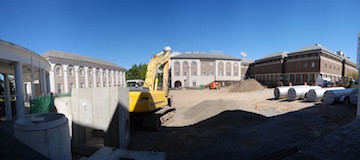
construction site - C.W. Courtney

The C.W. Courtney Company, a general civil engineering consulting firm providing integrated engineering services for projects in the fields of municipal, civil, and environmental engineering, is pleased to announce that Bryan R. Sparks has returned to the firm to continue his work as construction manager and CAD system coordinator. Additionally, beginning soon, Bryan will take on the duties of field (survey) crew coordinator. Bryan’s return to C.W. Courtney is the firm’s latest addition to its team of experienced construction project managers.

Bryan has deep roots in the Ohio area. He has spent over two decades in the land surveying and civil engineering industry with an unwavering focus on helping local clients achieve the highest quality and fastest results. In 1988, Bryan started his career as a board draftsman at a small engineering firm located in Fremont, Ohio and joined C.W. Courtney as a valued and experienced leader in his field. Bryan combines strong technical abilities with significant experience in the industry to make him highly qualified to provide support services to lead design engineers. Bryan also has substantial knowledge of CAD drafting and CAD systems and has the expertise to successfully take projects from concept all the way through to completion.

A respected industry leader in the region, Bryan holds a bachelor’s degree in construction engineering (University of Akron), an associate’s degree in architectural construction (Terra Community College), and is a veteran of the Ohio National Guard.

C.W. Courtney has a unique business perspective thanks to its diverse client base in both the municipal and private sectors. Every project at C.W. Courtney utilizes the expertise of a senior engineer in conjunction with junior engineers. In its over 100 years of business, the firm has been continuously serving clients in civil engineering and land surveying with a steadfast commitment to developing quality engineering solutions.

C.W. Courtney Congratulates University of Akron Men’s Soccer Team

All of us here at C.W. Courtney congratulate the University of Akron men’s soccer team on their successful 2015 season.

After defeating Rutgers 6-0 in the second round of the Division 1 Men’s Soccer Championships, they went on to victory against Southern Methodist University in the third round. They followed up with a 3-2 win over Creighton in the quarterfinals when Adam Najem scored in double overtime, clinching their spot in the semifinals. The 0-0 tie against Stanford in the semifinals led to a narrow win by Stanford, this season’s national champions, with a game-winning double-overtime penalty kick. The game marked their second meeting with Stanford, the first being in 2009 when the Zips clinched a 2-0 victory.

The 2015 season is the Akron Zips’ most successful since 2010, when they won the NCAA Men’s Soccer Championship for the first time in the team’s history. Third-year head coach Jared Embick, who is in his ninth season as a member of the Zips’ coaching staff, and assistant coaches Olivier Slawson and Carl Capellas led an impressive team, including standout goalkeeper Jake Fenlason. Other team standouts include starter Andrew Souders (senior); tournament goal leader Stuart Holthusen (sophomore); Sean Sepe (senior); and juniors Victor Souto, Richie Laryea, and Goncalo Soares. Although a few senior players will no longer be members of the team next season, Embick has told local press that the support for the team and remaining players are key components in the team’s success, so he has high hopes for its future.

The C.W. Courtney team is especially supportive of our local Zips men’s soccer team because four of our staff are Akron alumni! We’re proud to have such skilled, knowledgeable professionals on board from such a prominent institution. Congratulations again to the University of Akron. We look forward to the 2016 men’s soccer season and wish you the best!

Thanks to faungg’s photos on flickr for the image used in this post.

The New Transportation Bill: Safety, Finances, and What It Means for You

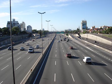
Highway - The C.W. Courtney Company

The negotiations are finally over. Congress has moved forward to approve a new transportation bill that allocates $305 billion in spending over the next five years to fund transit infrastructure throughout the nation. Obama signed the bill into law on December 4, 2015, just hours before the funding was due to expire.

The new law includes 1,300 pages of measures designed to ensure that road repairs throughout the country happen on schedule. Other provisions include a plan for maintaining gas prices, allowing pets on trains, and helping milk producers increase production.

Safety Enhancements

Anyone using highways, bridges, and tunnels throughout the country probably has concerns about potential safety issues, and while the passing of this bill may not ensure stress-free travel for all commuters, state and local governments should have the funding necessary to take care of ongoing repairs. These repairs will likely mean some amount of reduced congestion on the roadways, as well as improved designs and fewer potholes.

Train safety also gets a significant boost with passage of this law, which allocates $200 million for the installation of safety technology improvements in the nation’s railways.

Financial Benefits

The new law reauthorizes collection of the gas tax at 18.4 cents per gallon without raising it. This gas tax is responsible for funding transportation projects, and it covers a sizable deficit in funding that has grown in recent years due to increased fuel efficiency in U.S. automobiles. The means used to control the gas tax include reducing the dividend rate on Federal Reserve payments and contracting out tax collection services for the IRS.

The law guarantees five years of federal funding for local and state governments to focus on infrastructure repairs, allowing them to begin planning the projects that will benefit commuters and travelers over the course of the next few years.

Bioretention 101: Design, Construction, and Maintenance

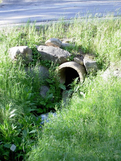
CW Courtney Bioretention 101

On June 9th and 10th, our engineers were invited to attend the Low Impact Development seminar. During the two-day survey, attendees not only learned about LID and the performance policy implication in Ohio, but also about bioretention design, construction, and maintenance.

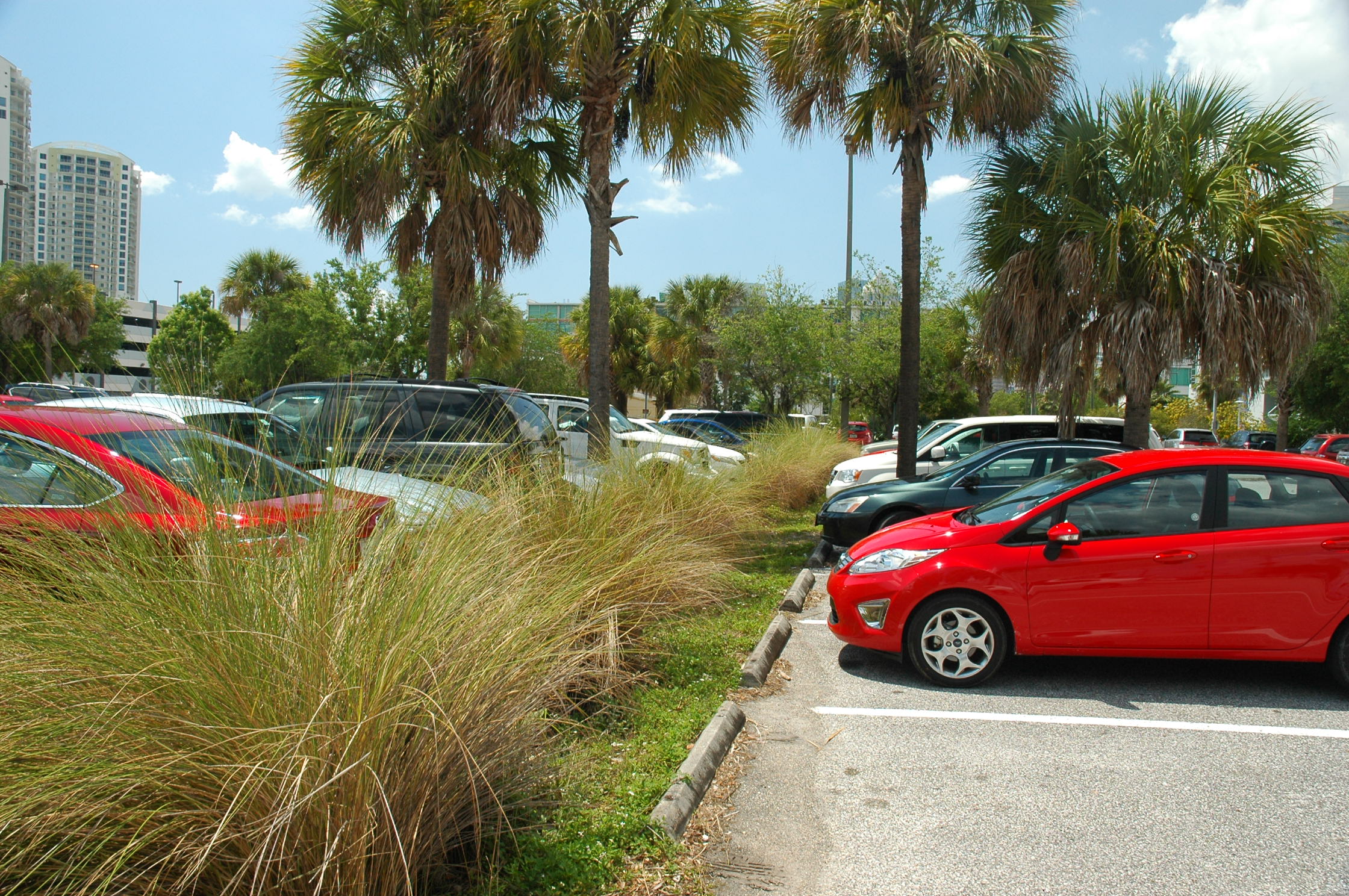
Bioretention areas are landscape features that store and treat stormwater runoff on development sites. Commonly, these features are located in or around parking areas and, less frequently, in residential neighborhoods. While they are used to store and treat stormwater, this landscape architectural feature is not considered a stormwater wetland.

Design

One particular design discussed at the seminar was for soils that are suitable for infiltration. In these areas, it is possible to construct an undertraining system, which can be modified for infiltration. In this system, the pipe is installed near the top of the deep gravel layer. This creates a “sump” that collects and stores water for infiltration.

This is just one example out of the four bioretention design concepts considered most useful to Northern Ohio. To choose the best design, soil testing is advised. While soil maps help to indicate the dominant soil in a given area, trained scientists can tell builders the specifics about the properties and soil makeup. Armed with this information, we can choose the best bioretention design based on the unique properties and stormwater runoff needs of a specific area.

To pick the perfect site, many factors need to be considered, including site slopes, drainage area, bedrock, floodplain and wetlands, base flows and chlorinated flows, stormwater hot spots, and aesthetics. Before construction begins, all contributing drainage in the area needs to be stabilized.

Construction

Inspection of the site should start during construction. This includes testing of the soil mix and infiltration design. After proper testing, the site should be evacuated to exact dimensions. The evacuation technique will depend on the design chosen. Tilling tools are then used to refracture the soil structure and prepare the site for the underdrain pipe. The bioretention wells/cleanouts will be placed into the site vertically, and then soil can be added in horizontal layers. The final step is plant installation, which helps ensure the integrity of this new bioretention area. After construction, the site should be inspected to ensure it is built to certification.

Maintenance

After the construction is complete, maintenance continues. For optimal performance, make sure the filter bed functions and drains at a proper rate. Maintaining all of the vegetation is also crucial for integrity of the bioretention unit. All pretreatment should be checked and drains should be free of clogs.

Proper bioretention construction and oversight means that an area will have pollutant removal mechanisms that are found in nature.

Special thanks to Dan4th Nicholas for the image of this bioretention area.

Modern Stormwater Management Practices

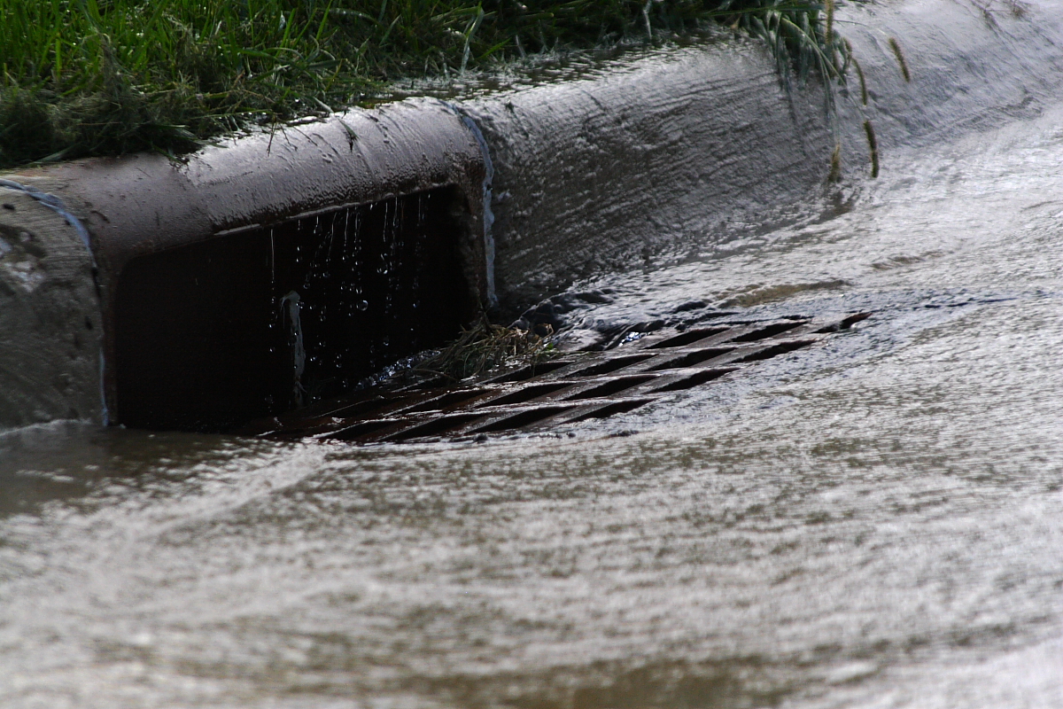
A storm drain - CW Courtney Company

With land development increasing at twice the pace of population growth, American builders must consider the toll these projects are taking on the environment. Chief among them is the impairment of shared water resources due to stormwater runoff. Caused by a marked increase in impervious structures, the degradation of rivers, streams, and reservoirs, stormwater runoff negatively affects local communities. To deal with these issues, responsible water management policies have been imposed by state and federal governments. The Low Impact Development Performance and Policy Implications in Ohio workshop recently explored these topics to better understand the future of water management in the region. Here are a few of the stabilization practices highlighted during the two-day event.

Landscape Maintenance

Because stormwater runoff causes soil erosion, protective measures must be taken to protect at-risk earth. Adding perennial vegetative cover, turf reinforcement matting, and landscape mulching can stabilize soil and reduce the risk of rapid erosion. But because these additions require regular maintenance, they can be quite costly for small communities. In areas where the earth is bare and exposed to the elements, re-seeding the soil with common grasses is an affordable option. Lack of vegetative cover may also be caused by poor fertility, which can often be corrected with fertilizer or lime. According to standard guidelines, communities should strive to achieve a 70 percent vegetative density in all at-risk areas. This can help ensure stormwater runoff will not cause devastating soil erosion issues that can have far-reaching effects on local water sources.

Protecting Parking Lot Perimeters

Because they are large, impervious structures, parking lots are a major cause of stormwater runoff. Whether the runoff is transported to a water basin or retention cell directly or via curb cuts, these areas are susceptible to soil erosion. Placing rip-rap in these spots can greatly reduce the risk of destabilization. When done correctly, nearby water sources, such as rivers and streams, should be safe from unwanted inflows.

Cleaning Outlet Structures

As mentioned, stormwater runoff must end up somewhere. When safely transported to an outlet structure, such as a water basin or water wetland, dewatering can be controlled. But when these structures become clogged because of sediment, floating trash, or debris, storage areas may overflow, causing it to flood surrounding areas. Excessive amounts of waste can also harm wildlife and may be dangerous to humans if it gets into drinking water. The easiest way to deal with this problem is to have a cleanup crew unclog the outlet with shovels, rakes, and other hand tools. Water basins and wetlands should be inspected for clogs on a regular basis.

Installing Water Storage Structures

When stormwater runoff cannot be controlled through maintenance and stabilization, it may be necessary to put in additional storage structures. When installed near at-risk areas, a catch basin can prevent flooding and widespread stormwater runoff. As mentioned, however, these structures must be maintained to prevent overflows caused by clogs. On the plus side, catch basins are relatively easy and inexpensive to install.

Local communities can use these simple strategies to prevent the devastating effects of stormwater runoff.

Low Impact Development Performance Seminar – Two Site Visits with Policy Implications in Ohio

The C. W. Courtney Company

The Low Impact Development (LID) Seminar was held June 9th and 10th, 2015. The two-day symposium covered topics concerning bioretention, LID stormwater controls, and permeable pavement.

Both days began with a talk on the evaluation of the performance of LID stormwater control measures in Northern Ohio. The implementation of credits and incentives is helping to promote newer stormwater runoff controls, which reduces the impact of runoff in Ohio’s coastal communities. By design, these resources will effectively remove nutrients, metals, and pathogens from stormwater and allow the rainwater to be reused through natural systems. Both days of the seminar ended with site visits that exemplify innovative stormwater management through permeable pavement and bioretention cells.

Perkins Township Visit

During the June 9th seminar, the group made a site visit to the Perkins Township Administration Complex. The site was an abandoned commercial plaza that the Perkins Township Trustees rehabilitated to be the new location of the Township’s administrative offices. The soil from this area drains into Pipe Creek, a warm water habitat stream that flows into the East Sandusky Bay. Because of the site’s proximity to this stream, an LID approach was implemented to create functional site drainage that encourages the natural movement of water within the stream. During the rehabilitation project, part of the existing parking lot was replaced with pervious concrete. The renovated system allows runoff from the roof and impervious concrete lane to drain through the previous concrete area.

The design of the new drainage system incorporates much of the existing infrastructure. Originally, the site was to have a bioretention cell under the pavement. The depth requirement for the cell, however, could not be achieved due to a lack of elevation change between the control measures and the existing sewer system. Instead, the site design incorporates impervious concrete drive lanes that drain into nearby pervious concrete parking bays. Other important design features include the roof runoff pipe to be plumbed into the subgrade of the pervious concrete. This practice is acceptable because much of the water is considered cleaner. With the construction complete, runoff from the western pervious concrete system has been reduced by 47 percent.

Orange Village Visit

On June 10th, attendees visited the Orange Village Service Facility. The parking area was retrofitted with permeable pavers and bioretention cells in the summer of 2013. The site was part of an Ohio EPA funded project that replaced 9,420 square feet of concrete with the permeable pavers. This included a permeable paver driveway, which had no prior stormwater treatment. Under the pavers is 520 square feet of bioretention cells to help clean runoff. The site also has two six-inch diameter curtain drains installed beneath the pavers to help dewater the groundwater table.

The Orange Village Service Center continues to be monitored by the CRWPs as part of their National Estuarine Research Reserve Science Collaborative research initiative. Due to the curtain drains dewatering a larger area than the SCMs, it has been difficult to calculate the total water balance. With that in mind, the site has seen over 98 percent of the inflow leave the LID system as exfiltration or evaporation over the past year. No runoff has been observed during the monitoring period.

Accessing the Green Infrastructure Grant Program

https://www.flickr.com/photos/84382111@N04/7726592760/in/photolist-cLLNQy-334sm8-334sgk-cLLPB7-cLLPfU-cLLQbs-cLLP3d-cLLPnS-cLLPWy-cLLPHG-cLLQ4Y-cLLP9w-cLLQjC-334rYt-338QDL-334joM-338Xym-334oAM-338TY5-338QTN-334qqV-338WHL-334oER-334uhx-334src-338YqE-338ZMC-338UQ9-338WXy-334jMa-338XQE-334s4z-334tNr-334tCX-338VvN-334sUe-338VQo-3391JL-338UV1-338WPG-334pnr-334nrP-334omD-334sEK-334rkB-334oVx-334nYD-334tHR-334pzc-334sv4

The Green Infrastructure Grant Program is open to nonprofit organizations and communities looking to reduce the burden on the Sewer District’s system in their area. In order to qualify, the reduction will need to be shown to be long-term and significant.

Low Impact Development (LID) projects, sometimes called “green builds,” which decrease the amount of stormwater runoff, reduce maintenance and repair costs associated with the Sewer District’s equipment and infrastructure. When the water flow is reduced through redirection into uses such as irrigation of plant life, it lessens the pressure on the system as a whole. Therefore, the grant program seeks to encourage nonprofits, and community partner groups to reduce costs and minimize the negative impacts upon the environment from excess wastewater.

Communities, nonprofit organizations, and businesses that partner with nonprofits may apply for funding through the Green Infrastructure Grant Program. Like most programs, the Green Infrastructure Grant Program has some limitations and regulations. For example, the funding cannot be used to solve legal compliance issues or mitigation. The funds may cover engineering and design fees, as well as studies for structural soundness and for any necessary soil testing. Equipment rental, the purchase of materials and plants, and labor are also allowable expenses under the program.

Projects may include parking lots with foliage and landscaping included in such a way that water runoff is reduced, the addition of a rooftop garden which utilizes stormwater runoff for irrigation, or other projects that reduce the impact of stormwater runoff on the sewer system. An experienced engineer or team can help design a project that meets the requirements of the grant program and the needs being addressed by the project in the most efficient manner possible.

By taking advantage of programs like the Green Infrastructure Grants Program, groups and businesses who partner with a nonprofit or community can reduce the costs of a Low Impact Design (LID) project, and in turn benefit both the community and the environment.

Photo Credit: Ekistics Design Studio